


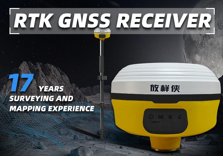
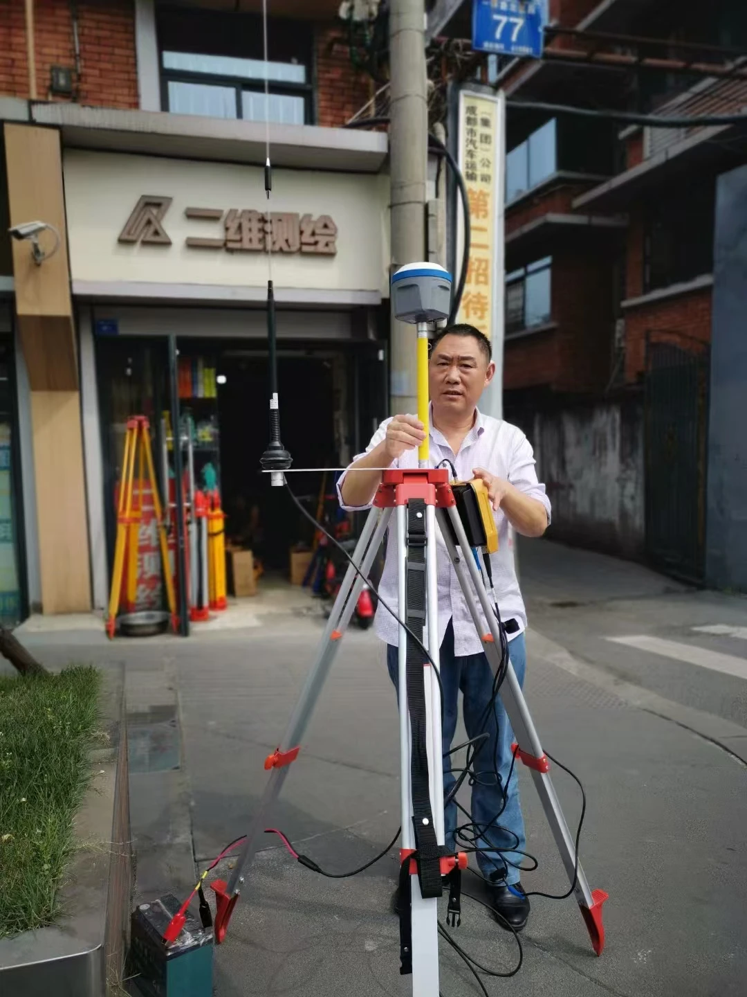
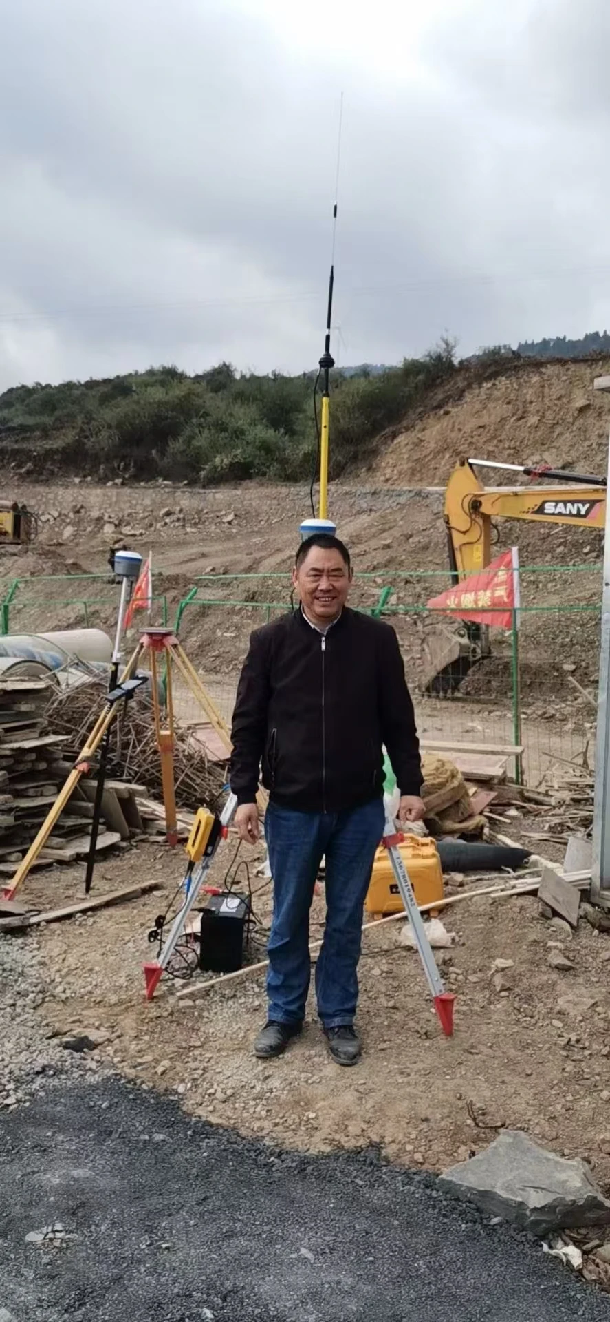
 อุปกรณ์รับสัญญาณเสาอากาศ RTK GPS GNSS พร้อมฐานขาตั้งสำหรับทำแผนที่ทางวิศวกรรมอุปกรณ์วัดตำแหน่งปรับแต่งได้ตามต้องการ
 อะไหล่ฟรี

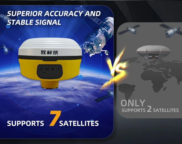
Satellite reception
| GPS: L1C/A,L2PL1C,L2C,L5 BDS-2:B1I,B2I,B3I BD5-3:BIC,B2a.B26,B2B-pPP GLONASS:G1C,G1P,G2C,G2P,G3 Galileo : E1,E5b,E5a,E5AItBOC,E6C QZ55:L1C/A,L20,L5,L1C,L1S,L5S,L6 NAVIC: L5 SBAS: LIC/A.L5C |
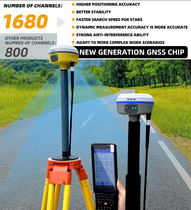
Number of channels
| 1680 |
OUTPUT FREQUENCY | Maximum 20Hz |
Operatingsystem | Linux |
Initialization time | <5S(typical value) |
Initialization reliability | 99.99% |
Static plane accuracy | 士(2.5+0.5x10-d) millimeters |
Static elevationaccuraCy | Soil (5+0.5X10⁻⁹D)mm |
RTK plane accuracy | ± (8+1.0 x10-d) millimeters |
RTK elevation accuracy | ±(15+1.0 x10-d) millimeters |
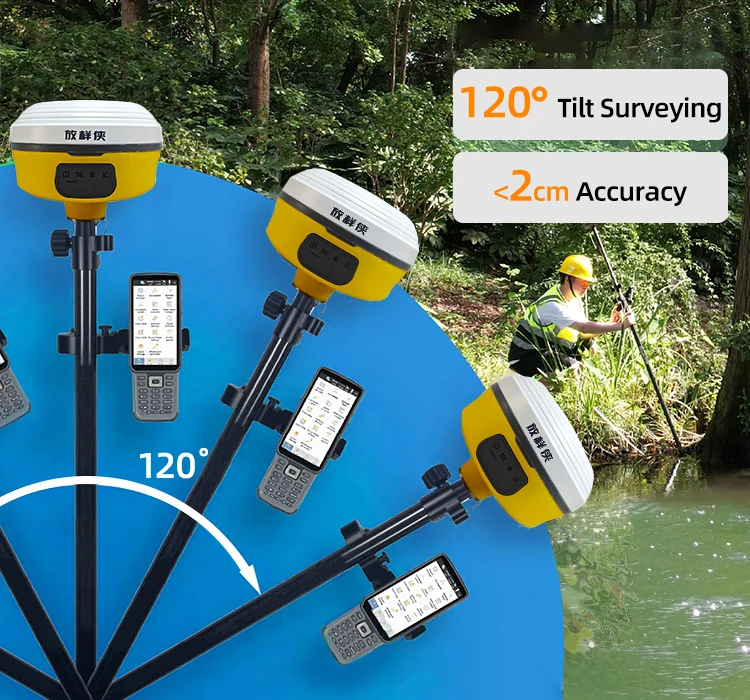
Inertial navigation accuraCy | <2cm within 30° |
Battery capacity | 10000 milliampere hours |
Endurance time | Mobile station CORS mode for 20 hours |
Extemal power supply | Support fast charge, support charging bank |
Differential data | RTCM2。Xrtc3。X |
GPS output data format | NMEA 0183, PJK, binary code |
support secondarydevelopment | Support development of sDK packages |
Drone base station | Real-time differential service for UAVs |
camera | 5M HD camera large wide-angle AR real scene lofting |
Voice | Manual speech |
PPK measurement | support |
Static measurement | support |
1/0/0 interface | Type-C port Supports power supply anddata transmission SMA radio antenna ports |
Wireless communication | Bluetooth support |
Serial communication | Five-pin serial transmission |
Built-in storage | 8 gb |
Network communication | 4G full Netcom |
TCP protocol forwarding | TCP protocol forwarding |
Inertial navigation | TCP protocol forwarding |
Built-in station | Built-in receiving station |
Transceiver integrated station | 2W transceiver integrated radio |
Built-in station frequency | 410-470 MHz |
Communication protocol | Trarspsrent agreement,/Trimtak SOUTH19200 / SОUTH96ОО |
dimension | 100 * 89 millimeters |
weight | 470 grams |
key | single key |
Pilot lamp | Satellite light + data light + power light + Bluetoothlight |
Operating temperature | -45°C~+75°C |
Storage temperature | -55℃~+ 85°C |
aseismatic | IK08 |
Dustproof and waterproof | IP67 |
3M waterproof breathable membrane | support |
Fall prevention | Resistance to 1.8 m drop with the bar |


ทุกการชำระเงินที่คุณทำบน Cooig.com มีความปลอดภัยด้วยการเข้ารหัส SSL และโปรโตคอลการป้องกันข้อมูล PCI DSS ที่เข้มงวด

ขอรับเงินคืนหากคำสั่งซื้อของคุณไม่ได้จัดส่ง สูญหาย หรือสินค้าที่มาถึงมีปัญหาที่ตัวผลิตภัณฑ์ พร้อมคืนสินค้าในพื้นที่ฟรีเมื่อมีข้อบกพร่อง